Inside-model steering
Geometric Saliency-Guided Token Compression
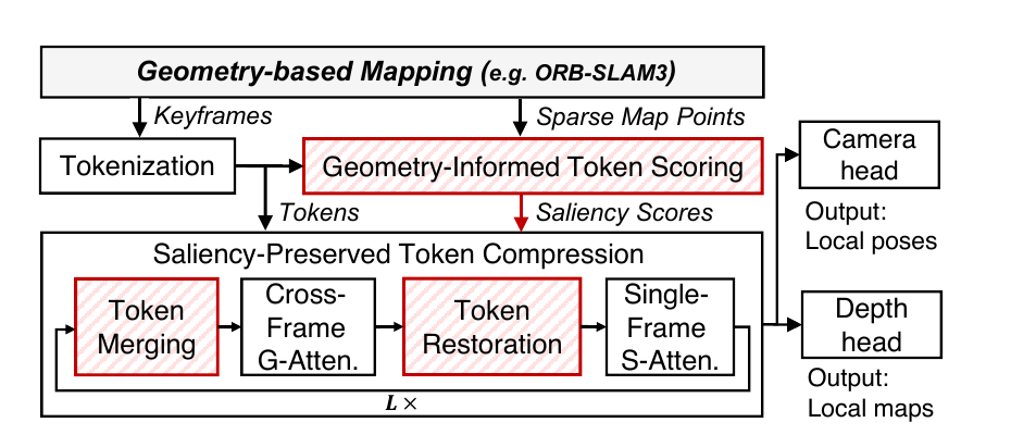
Protect geometrically supported tokens, merge redundant tokens before cross-frame attention, and restore the full layout for prediction.
Long-horizon streaming dense mapping
Orchestrating Vision Foundation Models with Lightweight Geometry for Long-Horizon Dense Mapping
SteerMap keeps lightweight mapping AI online and invokes a heavyweight vision foundation model on demand. Geometry steers what the model preserves, where local maps move, and which inconsistent regions must be reconstructed.
Overview
Existing systemskeep a heavyweight VFM in the loop for both dense reconstruction and global consistency.
SteerMapkeeps lightweight geometry in the loop and invokes the VFM only when dense reconstruction is needed.
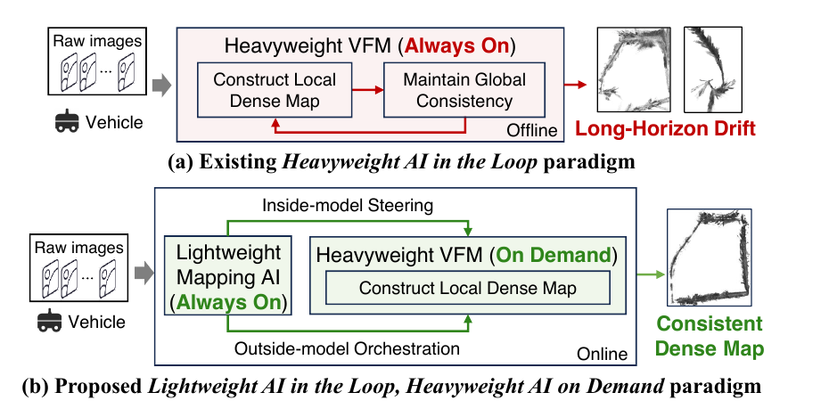
The always-on geometry mapper continuously exposes camera poses, sparse map points, and observations. SteerMap uses this state to accelerate local-map generation and maintain global consistency as maps evolve.
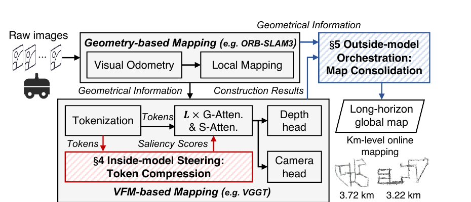
Method
Inside the model — Faster local mapping.Geometry-aware token compression accelerates VFM inference while preserving local-map quality.
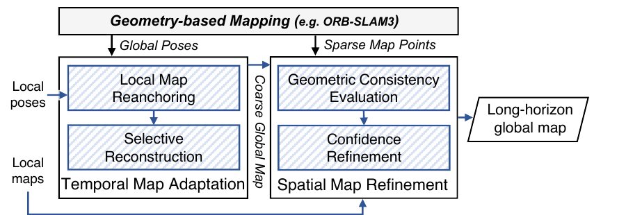
Outside the model — Globally consistent mapping.Reanchor valid maps and reconstruct only inconsistent regions as poses evolve.
Protect geometrically supported tokens, merge redundant tokens before cross-frame attention, and restore the full layout for prediction.
Reanchor reusable local maps, selectively reconstruct inconsistent segments, and refine dense confidence with reliable sparse geometry.
Videos
All videos are presented with native browser controls. Open full screen to inspect trajectory evolution and reconstruction details.
A 30-second view of SteerMap processing KITTI 00 as the vehicle traverses the sequence.
Four-method comparison on KITTI 00 (3.724 km).
Four-method comparison on our outdoor traversal (1.17 km).
Quantitative results
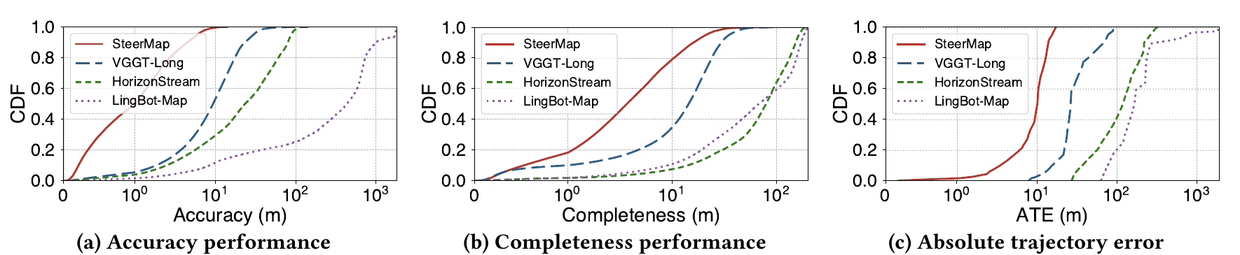
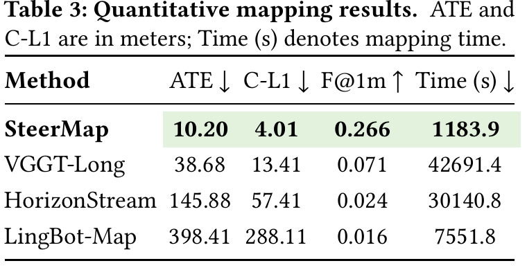
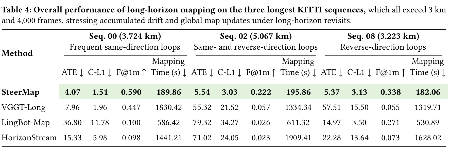
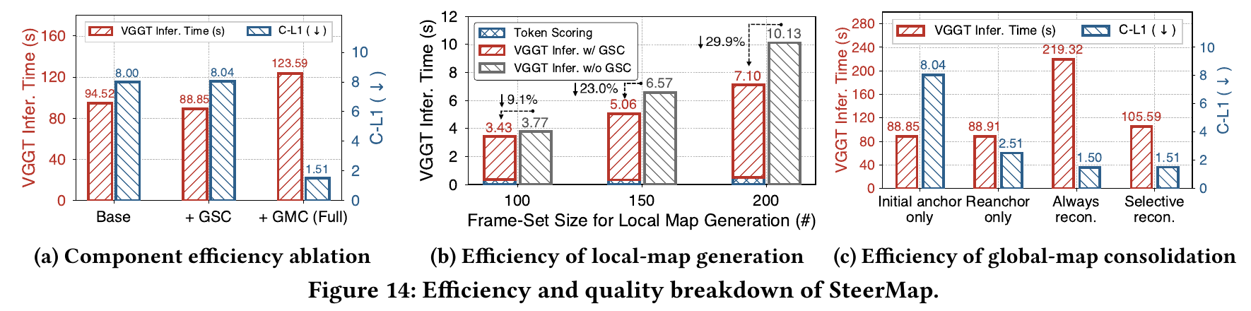
Selected quantitative results below are extracted directly from the submitted paper. Click any figure to inspect it at full resolution.
Code and data
The repository contains the runnable KITTI 00 pipeline, causal SLAM revision reader, configuration, evaluation tools, and instructions for obtaining the review data.