Global-geometry inconsistency
Independent VFM calls produce plausible local maps, but later trajectory corrections do not automatically repair maps built earlier.
Long-Horizon Dense Mapping
Steering Heavyweight AI with Lightweight AI for Long-Horizon Dense Mapping
SteerMap turns the lightweight mapping AI already running for localization into a geometric control plane for an on-demand vision foundation model. It decides what to preserve inside each call and where dense local maps belong across calls.
Problem and insight
A kilometer-scale route produces thousands of images, exceeds the memory budget of a single VFM call, and revisits regions whose poses may later change after loop closure.
Independent VFM calls produce plausible local maps, but later trajectory corrections do not automatically repair maps built earlier.
Cross-frame attention repeatedly processes overlapping visual evidence, while the number of expensive calls grows with trajectory length.
Unlike existing pipelines that ask a heavyweight VFM to both reconstruct local geometry and maintain global consistency, SteerMap uses persistent lightweight geometry to steer when and how the VFM is used.
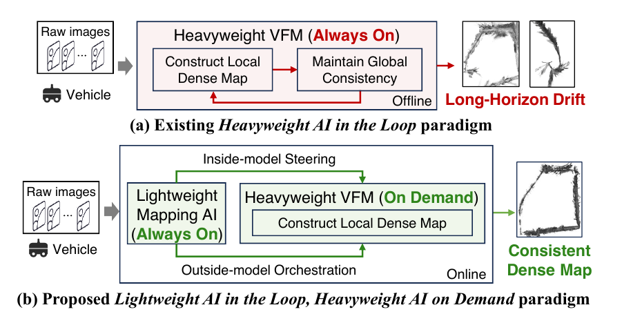
The always-on mapper continuously exposes keyframes, camera poses, sparse map points, and multi-view observations. The same state reduces computation inside the VFM and consolidates dense maps outside it.
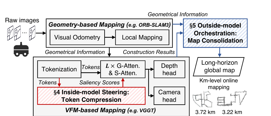
Method
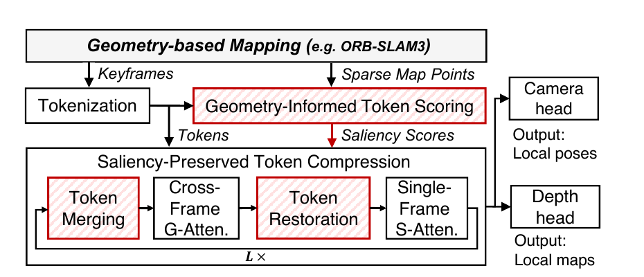
Inside-Model SteeringSpend attention on geometrically important evidence while compressing repeated content.
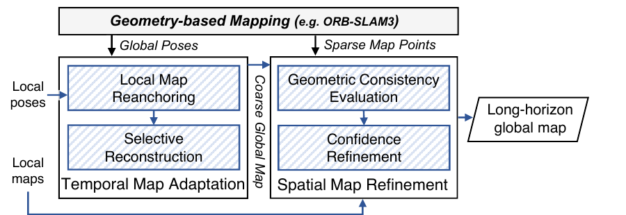
Outside-Model OrchestrationReuse valid dense geometry as poses evolve and reconstruct only what can no longer be explained coherently.
Project sparse multi-view observations onto the token grid, protect reconstruction-critical evidence, merge redundant tokens before cross-frame global attention, and restore the full layout before downstream prediction.
Use the latest global trajectory to reanchor reusable local maps, selectively reconstruct inconsistent frame sets, and refine dense confidence through sparse–dense geometric agreement.
Videos
These demonstrations complement the paper with causal map evolution and full-sequence comparisons. Open full screen to inspect trajectory changes and reconstruction details.
A 30-second view of SteerMap processing KITTI 00 as the vehicle traverses the sequence.
Four-method comparison on our outdoor traversal (1.17 km).
Four-method comparison on KITTI 00 (3.724 km).
Review artifact
The anonymous artifact contains the runnable KITTI 00 pipeline, causal geometric-state reader, configurations, evaluation tools, and instructions for obtaining the review data.